It wasn’t his business; he worked for the railroad, but he was a carman, a mechanic, working on the track and the big freight cars that traveled on it. Apart from frequent trips around the state to the site of various breakdowns and derailments, he spent all his working life around the big Burlington Northern shops in Spokane and, later, Wenatchee.
The job was a good, solid one of the sort that folks aspired to in the post-war years and I think he enjoyed it. But his heart seemed to be out on the road. Weekends, vacations, and sometimes even just after work, Grandpa was out driving. He had his favorite places, and he would return to them regularly, so regularly that, toward the end of his life, when he was starting to forget just about everything else, he could still accurately and cogently describe unmarked and un-named roads and routes in the remote parts of the West he had explored fifty years before.
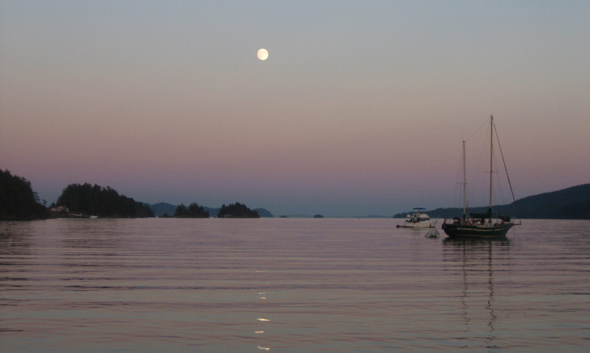
Along the Swinomish Channel
By the time I came along, he liked to boast that he had been to forty-eight states; all of them except Alaska, and, he would reveal after a beat, New Jersey. Eventually he knocked those off the list as well.
It wasn’t long before I was going with him… since before my eyes had opened, he liked to tell people. Sitting in the passenger seat, I’d been to twenty-five of the fifty states before I was fourteen. I’d been to Wall Drug, the Corn Palace, saw Yellowstone any number of times before it burned, been to the Thousand Islands, toured Gettysburg, learned to see the stark and terrible beauty in Death Valley, bestrode the mighty Mississippi at its headwaters, watched the waves boil in off the Atlantic at Cape Cod.
People go cruising for different reasons. Some like the simplicity of life aboard, some love to sail, some like to go unusual places and see interesting things. I enjoy all of those, but for me I think most of it is the traveling. And I think I must have caught that bug from him.
That’s a real sailor’s uniform, but Grandpa spent his service ashore as an aviation ordnanceman
He wasn’t a sailor, though he had been in the Navy during the war (firmly ashore at Pearl Harbor for the duration)–he got terribly seasick. But the country we are sailing through would have fascinated him. He was a rockhound, enjoyed mountains and geography, and would have found a million things to notice in the tale of geographic history writ large on the upthrust granite walls lining our route. He also liked meeting people (and they him) and he would have gotten a kick out of the various characters who occupy the wilderness here as well as those who are simply sailing through it.
Grandpa passed away in 2008, only days after we returned from our first extended sailing trip up the Inside Passage. My mother had called to let us know he was going downhill fast and we rushed over to Spokane almost as soon as we had the docklines tied off. That night, alone with him for a moment in his room at the VA, listening to the labored breathing, I told him it was okay to go; I’d see him again, and we’d take another trip sometime.
He passed away later that night.
So, this trip, I brought him along. We’re traveling with Grandpa once again.
My uncle divided up the ashes amongst a few of our clan who continue to trek along the backwoods and backroads of the world, with the stricture that, when we came to a place we thought he might like, we should leave a little bit of him there. It’s an elegant way to remember and honor a man who went all over, but still never had enough time to get everywhere he might have wanted to see. My uncle carries his share around in a salt shaker.
So Grandpa is still traveling, and now he’s been a whole raft of amazing new places he didn’t have a chance to see in life: Desolation Sound, Princess Louisa Inlet, the Klaskish Basin, Rugged Point, Hot Springs Cove, Barkley Sound.
At first, I was leaving behind a generous dollop. But the further I go, the less I have been scattering. There are so many more places to travel! I don’t want to run out; I’m still riding with Grandpa.
Victoria, Victoria… what city harbor in the Pacific Northwest could rival it for beauty and maritime history? Capital of British Columbia, blessed with a wonderful and gorgeous downtown waterfront featuring capital architecture and vibrant activity, the city figures prominently in the nautical history of not just the region, but of the entire North Pacific Ocean.
Equidistant from Seattle and Vancouver, the two great population centers of the region, Victoria beckons sailors looking for a quick weekend away from home. Located squarely in the mask of the same rain shadow that makes Sequim one of the sunniest places in Western Washington, Victoria also enjoys enviable weather for getaways even in the winter months.
But Victoria offers some challenges to the cheap sailor. The best anchorage in the most desirable location–the Inner Harbour–is entirely off-limits to anchoring. Much admiration and approval has been written elsewhere about the picturesque Causeway floats and enormous convenience of the other available public floats in the Inner Harbour, all of it entirely true, but it’s also indisputably the case that they are not cheap: at 1.80 CAD per foot during the high season, they are in-line or a bit higher than most private marinas in the area. While the value this pricing represents is great, it’s not in keeping with the cheap sailor’s intent to pay market rates.
The areas north of the city along the Saanich Peninsula also offer a wide variety of marinas and a number of good anchorages, but those will be outside the scope of consideration for this discussion. It’s certainly possible to reach Victoria easily from Sidney by rental car or public transit, but we wanted to find a closer alternative (particularly considering the poor experiences we had with the Victoria Regional Transit System).
Anchorages
The Fisgard Point Light, at the entrance to Esquimalt Harbour
Pickings are sparse for secure all-weather anchorages in Victoria. Cadboro and Oak Bay both leap out as options from a quick look at the charts.
Unfortunately, both these locations share the same general deficiency, which is that they offer very little protection against any sort of southerly wind. Southwesterlies are common in the summer months as the turbo-charged west wind roars in off the Strait of Juan de Fuca and curls up through Haro Strait. And the winter southeasterlies that howl up from Puget Sound are not to be trifled with in the colder months, either.
Gonzales Bay was brought to our attention as a possibility, but it is both small and shallow for the average cruising sailboat.
However, any of these three could be reasonable options in the correct weather conditions.
Fleming Bay is also mentioned in several guidebooks but it’s tiny and we’ve heard tell the locals strongly discourage anchoring there.
The best all-weather anchorage for Victoria, we feel, is Esquimalt Harbour. Esquimalt offers several options with good holding and fair protection, including Thetis Cove, Cole Island, and Limekiln Cove. A dinghy with a good engine or an oarsman with a strong back will be required to explore the full range of the harbour from any of these anchorages, however. Thetis Cove is the closest to the best landing spot, Portage Park.
Located to the west of the Inner Harbour, off Royal Roads, Esquimalt is, and has been since 1865, the home of the Royal Canadian Navy’s main West Coast base, HMCS Naden. Almost no one actually calls it Naden. Regardless, the Queen’s Harbourmaster controls access to all of Esquimalt harbour and you are required to check in with them on VHF channel 10 when entering or getting underway within the waterway. Try as I might, after listening in on the ops channel for four days straight, I could never quite catch the common call sign for QHM; however, they did answer to “Harbor Control” when I hailed and simply requested a destination both coming in and heading out. There were no hassles involved.
The best guidebook we found for all these areas (and many others besides) is a little-known digital publication from Salish Sea Pilot. The free, downloadable PDF guide for the Gulf Islands (they offer an equally up-to-date and easy-to-use guide for the San Juans) is the clearest, most informative, most comprehensive guide to anchorages and landings available to day, bar none–including the expensive annual publications covering the region.
Although “cheap” is usually synonymous with “anchoring” in this part of the world, we found the best option to be the exercise of our reciprocal mooring privileges with the Canadian Forces Sailing Association (CFSA). Located adjacent to the Esquimalt Graving Dock, the CFSA docks and clubhouse are quaint and lovely and active. The facilities are excellent and the members and staff friendly and accommodating. We can’t recommend a stop there highly enough, should you happen to belong to a club that has an agreement with them.
Landings
In a city with few good available anchorages, it should come as no surprise that there are also very few places convenient for sailors to land their dinghies.
Beach landings are possible at the public beaches in Cadboro and Oak Bay, although the security of your unattended dinghy may be an open question. Both bays host marinas; it’s possible that some wheedling and a fresh crab or two might earn you a dinghy spot at the docks for coming and going during business hours.
An orca shrubbery outside the Empress, the only sign of the marine mammal we saw near Victoria on this trip
Similarly, Portage Regional Park in Esquimalt offers beach access, but uncertain security, particularly after dark. However, there are places where you could reasonably conceal most small dinghies (small dinghies being the most likely sort for a cheap sailor to possess). Whether or not hiding it makes it more or less susceptible to shenanigans is a judgement call left to the reader.
Surrounding Neighborhoods
Esquimalt itself presents as very blue-collar and suburban. The massive graving dock and naval base dominate the Esquimalt Harbour side of the peninsula; gleaming, steel and glass high-rise projects line the Inner Harbour side. The lower peninsula, where you are likely to land and spend some of your time, is actually an amalgam of Esquimalt, the township of View Royal, and the Songhees Indian Reserve.
It’s about a 3 mile walk to downtown Victoria. Alternatively, the number 24 and 25 buses run from Admiral’s Walk to downtown. The bus will cost you $2.50 each way, unless you can find the elusive $5 day pass, which will let you ride as often as you like during a 24 hour period.
We asked a driver about the day pass–they don’t sell them on the bus. We stopped in at three different stores that are listed as pass suppliers, and they all were out of them, and all told us that they were almost always out of them, and that the Transit Authority refused to give out any more.
This intransigence became less puzzling throughout the day as various transit workers did their best to screw us over; we were shorted on time when we asked for transfers, and one driver (of a bus with plenty of empty seats left) just outright drove past us at a stop, despite our flailing hands and shouts. He just looked at us and shrugged as he drove on by.
So, if you can bring a bike, that’s what we would recommend. Otherwise, whether you would prefer to take the bus or not, be prepared to hike… there’s no guarantee they’ll let you on board the bus!
A particularly ambitious and athletic crew could follow the lead of the natives and portage their dinghy across from Portage Park into the Gorge Waterway, but be prepared for some strange looks as you cross the busy Island Highway.
Provisions and Services
There is an ideally situated shopping complex just up the street from Portage Park. Located at Admirals Road and Hallowell in View Royal, the Admiral’s Walk complex includes a Thrifty Foods, a Pharmasave drugstore, a few restaurants, and a laundromat.
A private housing development sits between the park and the shopping center, but the brand new Esquimalt and Nanaimo walking trail going in along the former rail line which skirts the park will allow an easy walk around the development and onto a public street flanking the complex.
You won’t find any Internet service to speak of in Esquimalt Harbour, and the Navy might take it the wrong way if you started monkeying around on deck with your super-powered wifi snooping antenna setup next to their base anyway.
Moka House coffee shop, in the Admiral’s Walk complex, does offer complimentary internet access for paying customers.
Things to See
The Japanese Garden at the Horticulture Centre of the Pacific
Here, again, Victoria is less accommodating to the cheap sailor than some other ports we could mention. It’s not that Victoria doesn’t have plenty of excellent things to see; it’s just that the best of them tend to be expensive… Butchart Gardens, the Royal British Columbia Museum, and Craigdarroch Castle are all marvelous, but will take a bite out of your wallet.
But there are a few alternatives–none of which eclipse the fact that you really should just cough up the cash to go see Butchart Gardens and the Royal BC Museum, as well.
We enjoyed just spending some time walking around Beacon Hill Park (which, by the way, has its own bit of nautical heritage to disgorge: the name comes from Mount Beacon, on which a range had been established to help guide early mariners into the harbour). The surrounding neighborhoods are equally charming, a mix of modern apartments, quaint cottages, and vintage Victorian houses on display. For the more astute observer, a wander around the streets of Victoria can be a history lesson in itself.
There are also the British Columbia parliament buildings (the other fascinating architectural exhibit overlooking the Inner Harbour) which may be toured for free.
Inside Bastion Square, near the Marine Museum
As an alternative to Butchart Gardens, consider visiting the Horticulture Centre of the Pacific. Maintained almost entirely by volunteers, the story behind the varied gardens there is interesting enough to warrant a visit in and of itself. But the gardens have a creditable selection of flowers and foliage, for folks who are into such things, as well as an artful Japanese Garden, and a nature trail through a conservancy area filled with birds and other wildlife.
Notwithstanding some recent structural problems, the Maritime Museum of British Columbia is also a must-see stop for visiting sailors. Located downtown in historic Bastion Square right off the Inner Harbour, the very building seems to ooze historical import.
With all this to do, and much more left unlisted, it’s a good thing Victoria is so close for most Northwest sailors… you’ll be back again and again and again and never exhaust the possibilities for entertainment and leisure available in British Columbia’s stately capital city.
It’s not actually fall here yet in Ucluelet. It just feels like it. The chill in the air, even when the sun emerges, dim and distant, from the rolling fog banks, just feels like fall. The smell of the fog in the trees, the sweaters worn by people on the streets, even the sign up at the local bakery: “Pumpkin Pies! Order yours today!” And with the first real frontal system of the year hovering out below the western horizon, advertising its imminent apperance with southeasterlies and the occasional thunderclap, it takes more than one glance at the calendar to convince me it’s not even mid-August here on the West Coast yet.
Which is a shame, because fall brings to mind thoughts of a return to work, of a deluge of pumpkin-flavored espresso drinks in cozy Seattle coffee shops, of unlimited dockside power, and watching Seahawks games in sports bars. In short, it makes us think of home, and between those thoughts and the dreary weather, we’re searching for a window ahead of that oncoming front to shoot back up the Strait on the last of the strong northwesterlies to leave Barkley Sound behind for another year.
A deer licks salt off the rocks on the beach at Ucluelet
We don’t really want to be thinking about these things right now, because Barkley Sound, and in particular the Broken Group Islands in its center, a part of Canada’s Pacific Rim National Park, is a childhood fantasy of barely-awash rocks, forested islands with cunningly shaped bays concealing secret caves, and fascinating sea-creatures just waiting to be explored and conquered in a youthful frenzy. It’s all I can do to keep myself, right at this very instant, from paddling the dinghy ashore and claiming a rugged-looking rock and its four hardy-looking trees for Scott-land (the standard fantasy country which I ruled, firmly but justly, in my youthful imagination) and begin building an impregnable fort thereupon from driftwood and rocks.
It’s fortunate my parents never actually brought me here when I was a boy; they would never have found me again amid all these amazing hideouts.
Even the weather would have provided little deterrent to my younger self. The streamers of fog tangled in the trees and leaving a grey tint to land and sea alike only increases the air of magic and mystery surrounding this place. The occasional beam of sunlight stabbing down through renders solitary islands in golden-green, suddenly three-dimensional, beckoning me on: “Over here! Explore me next!”
Ucluelet, at the northern edge of all this wonder, has been dubbed (in that inimitable Canadian way of managing to give even geographic features nicknames that sound like they should belong to hockey players) “Ukee” by the locals. The village looks like a place that is waiting to happen (motto on the district website: “Life on the Edge”). A large, modern-looking community centre and library sits across the street from the beach; tiny, environmentally-friendly electric-powered Might-E trucks whisk district workers around the peninsula on their errands; vast tracts of platted subdivisions wind through the hills overlooking the ocean (or, rather, overlooking the fog where the ocean would be if you could see it), with fancy street number markers signifying lots which have not yet been cleared or built upon.
We stayed on the Japanese Dock, near the entrance to the small craft harbour. Although we had to forgo the pleasure of electricity or the shelter of the inner harbour, we found that the Japanese Dock isn’t waiting to happen; it’s happening now. Dinghies overturn, paramedics visit, colorful locals are hauled off to jail.
Waiting for the next big thing to happen at the Japanese Dock in Ucluelet
Just as we were getting ready to leave, another sailboat came in to land on the leeward side of the dock. I looked up and saw it pivoting out by the stern in the wind; something was amiss. I hopped off Rosie, ran over and took the stern line from the owner, who, as his boat was barndooring rapidly toward the hefty-looking stern of the wooden trawler behind him, calmly informed me that the bow line had come off and he was going to hop back aboard and “F– off for a bit,” which he proceeded to do in the nick of time. He then made a smooth 360 in the channel and re-fastened the bow line and came in again and executed a flawless landing.
He hopped off again and started to tell me the story of his difficult day, beginning with his anchor dragging overnight and his boat ending up tangled in a commercial crab float, then the bow line slipping off the cleat while his buddy was still holding the other end on the dock. I interupted him mid-sentence.
“Your stern line is about to do the same thing,” I said, pointing at the last little loop about to slide down the end of the cleat.
“F–ing h—!” he exclaimed and jumped back aboard.
Fall coming or no, it’s hard not to want to stay and see what happens next in Ucluelet.
They sometimes call this month “Fogust” out here on the west coast of Vancouver Island, and it’s been living up to the reputation so far this year. Our radar has gotten a good workout from the moment we crawled out of Bull Harbour all the way back down into the Strait of Juan de Fuca. We’ve had wind and fog, rain and fog, lightning and fog… even, sometimes, sun and fog, as the upper layer peels back and bathes the boat in a stream of brilliance from the heavens even as the surrounding water is obscured by thick, pearly walls.
Fog can be picturesque. There’s something supernatural about being completely cut off from the visual world when you’re inside a thick fog bank. If it’s not so thick, it can perform strange and wondrous tricks with views of already spectacular scenery… decorating a wooded slope with streaming tendrils, torn apart by the trees, gracing an otherwise pedestrian-looking rock with a crown of fluff, or merely rendering an entire vista in soft relief, as if through a vaseline-smeared lens. And it has it’s own sort of terrain features: fog lines, fog banks, fog mountains, fog rivers, fog canyons. Once, in bright sunshine, we even saw a fog-bow.
A Fog-Bow
But mostly it’s become an annoyance to us at this point. We’re out here, at least in part, for the scenery. And we can’t see it. We’ve had good sailing days and bad sailing days, but in the fog, good sailing becomes mediocre, and bad sailing, which otherwise would be tempered by the amazing spectacle of water, mountains, whales, and eagles, becomes miserable. It’s like being stuck in a sensory deprivation chamber–nothing but blank, undifferentiated whiteness at an unmeasurable distance. Without the steady visual cue of the horizon, my wife becomes even more susceptible to sea-sickness.
All that is just tourist whining, of course. The more serious problem is that fog makes sailing more dangerous. We lose much of our range of visual scanning for hazards on, and just beneath, the water. Deadheads and other semi-submerged obstacles appear out of nowhere. Reference points for navigation, including most marks, are unavailable.
Radar helps fill the gap with respect to large land masses and most other vessels, but it can prove as terrifying in its own way as the fog itself. Most radar users are familiar with the phenomena of “radar-assisted collisions,” perhaps most famously in the case of the Andrea Doria/Stockholm accident. Sometimes, knowing what’s out there is more dangerous than running blind.
Fog with a more menacing look as it rolls toward us near Cape Sutil
One afternoon as we meandered along at four knots or so through a bright glowing fog bank, I squinted at the radar display trying to make out a wavering blotch it painted intermittently about one mile ahead on my port bow. Before the fog had thickened up, I had spotted a large trawler and a smaller sport fisherman in the vicinity, but this return didn’t look like either of them. The bearing was steady and the distance was decreasing, but I couldn’t hear any engine sounds… another sailboat? The way it was fading in and out, it didn’t seem unlikely. And if, like us, they had white sails and a white hull, they’d be particularly difficult to pick out in the mist.
I watched anxiously as the range continued to decrease. Three-quarters of a mile, a half-mile, a quarter-mile… still no visual contact. As the range dropped, my blood pressure increased. I called Mandy on deck to help scan for it. Eventually, still with no sighting, it dropped away along our port side and I lost it. Mandy went back below and I tried to get my thumping heart rate back to normal.
A few minutes later, I glanced at the radar again. The contact was dead astern of us, at one mile… and closing! I flipped around, though I knew I couldn’t possibly see it, and stared out into the fog so intently that I started imaging things… dark shapes just out of sight, the white flashes of a bow-wave.
Just then, it occured to me that the monotonous groan of the radome spinning over my head was beating out the theme to Jaws.
I never did find out what that particular blip was. But we have had plenty of close calls all along the coast similar to that.
Plain Fog
What I think about most, though, was a tense ten minutes we had several years ago on a bright, sunny day in Mosquito Pass with not a shred of fog in sight. It was our very first passage through that picturesque, windy passage, and with our chart plotter running, depth-sounder sounding away, and all the relevant landmarks and navigational aids in plain sight, we anticipated no problems.
Then there was a loud “pop” from below, over the thrum of the diesel, and an acrid cloud of smoke drifted up out of the companionway. At the same moment, every electrical instrument on board went dead.
While Mandy scrambled below to fight any fires she might find, I was suddenly in an unfamiliar channel, notorious for currents and blind turns, without a depth reference or accurate position. A moment of panic passed quickly as I realized that an accurate chart was close at hand, and I could easily see all the channel markers and points along the passage. We made our way into Garrison Bay without further incident and found that the positive wire from the alternator had snapped off at the connector. Ten minutes with a crimper and spare connector and it was all fixed again.
Multi-layered fog
But the rapidity with which all our modern instrumentation can be put out of commission, in the worst spots at the worst moments, has stayed with me. Fog forces reliance on those instruments. We carry spares and have alternatives, but some of these are simply inadequate for navigation in zero visibility in tight quarters. Fifty years ago, before GPS and radar, people simply didn’t put themselves in those positions. But we do now, and think little of it. Until something goes wrong.
Naming one of the promontories along this coast “Rugged” is like naming one of the oceans “water” or “blue.” It lacks any artistic or descriptive value whatsoever; they’re all rugged up here.
Nonetheless, some unknown mariner or cartographer, perhaps having exhausted all the other possibilities by this stage, named the point at the southern entrance to Kyuquot Channel “Rugged Point.”
As if further evidence were needed of this unknown individual’s dereliction of naming duties, the lovely little sandy-beached cove carved out of the inside of the point remains on the chart to this day without any label on it at all. Visiting boaters and fishers have all been reduced to referring to it as “the bay behind Rugged Point.”
Despite this lack of attention from the naming authorities, the bay behind Rugged Point is a popular little spot in a remote part of the West Coast. It has been designated a BC Marine Park, and on the day that we arrived, after a long, lumpy passage in light winds and heavy fog along which we hadn’t seen another living soul, we found another sailboat anchored out in the cove, a small runabout near the beach, and a cheerful-looking group of kayakers clustered at the edge of the woods which fur the crest of the point and separate the sheltered inner cove from the roar of the Pacific a hundred meters away.
We were too tired for any more ruggedness that day, and as night fell, the fog that had lifted just long enough to allow us to anchor safely socked back in, tight. Overhead, our anchor light glowed like a small sun in all the mist, and a few hundred yards off, another brilliant glow in the darkness marked the position of our neighbor. Bats screeched overhead squeaking in peculiar patterns, as facile in fog as any other sort of weather thanks to their built-in sonar.
The next day, the fog lifted around noon and some rays of sun even broke through from time to time. Taking it as a sign, we piled into the dinghy and rowed ashore.
The beach goes on for miles
There are several lovely crescent beaches inside the point, but we were there for the big waves and distant horizons, so we ferreted out the short trail leading to the outside and headed that way. Miles of sand and logs, interspersed between rocky headlands, awaited us.
The beaches themselves are far from rugged; long, smooth, sand stretches out in the distance, scalloped out between a handful of rocky headlands, dotted with sea life. Those headlands, though, represent the rugged part. At low tide, it’s easy enough to follow the beach between them uninterrupted, but when the water rises, cutting across the heavily forested, rocky prominences could be formidable.
In places, the trails across the headlands are pretty steep, but the park is pretty posh by West Coast standards!
Fortunately, decades of visitors have carved out paths across the hills, and maintained them with cast-off bits of rope from their own boats or found on the shoreline. In one particularly steep spot, someone even erected a full-fledged ladder.
The beaches were busy, but serene nonetheless. Fog whispered across the sand, rolling back out to sea the further south we progressed, until, by the time we reached a small, curling freshwater stream just outside the park, we were in a pleasant splash of pale, warm sunlight. We went wading in the pools, and looked at flowers.
On the way back, we walked the high tide line. Covered with scattered logs of all shapes and sizes, like a giant-scale playroom spotted with cast-off Lincoln Logs. Scattered among the criss-crossed logs, we saw our first batch of Japanese debris; plastic bottles, mostly, some oddly-sized lumber that we slowly surmised must have come from a building of some sort. It was a sobering thought in an otherwise peaceful setting.